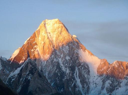
On 10 September 1856, Lieutenant-Colonel Thomas George Montgomerie (aged 26) climbed the glacial slopes of Haramukh (5,191 m), a well-defined peak 40 kilometres as the crow flies from Srinagar in Indian Kashmir. The simple lieutenant of the time was a humble link in the immense project initiated by the India Company in 1802, the aim of which was to scientifically measure all the territories of British India.
At the summit, Montgomerie pointed his theodolite at the mountains of the Karakoram range and began to measure their altitude. The Survey of India had determined the altitude of Everest and Kangchenjunga in 1852. He shuddered when a trigonometric survey showed a summit barely lower than Everest. In the dry nomenclature he drew up, he entered K2 (Karakoram 2): 8,619 meters, the second highest peak in the world... After careful calculations, the official altitude was set at 8,611 meters!
This measurement work was completed in 1871, as part of the Great Trigonometrical Survey of India, the service responsible for the topography of the British Raj.
In this article, we take a look back at the careers of the most emblematic early explorers and mountaineers who set out to discover the glaciers and peaks of the Karakoram.
See all our climbs above 8,000 meters.
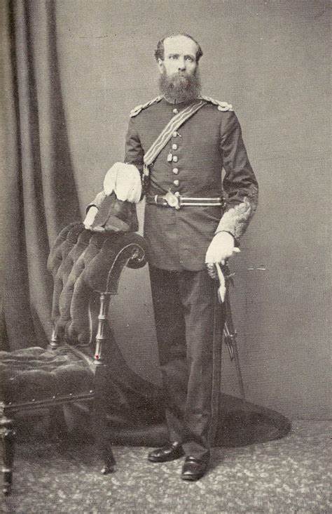
Thomas Montgomerie, the man who started it all
Karakoram: as big as Switzerland
To fully grasp the immensity of the Karakoram range (black rocks), we need to look at a few geographical facts: 400 kilometres from east to west, 120 kilometers from north to south, i.e. 48,000 square kilometres. By comparison, Switzerland measures 41,000 square kilometres.
But the disproportion is in the surface area of its glaciers, the largest outside the poles. Batura (58 km), Hispar (61 km), Biafo (60 km), Baltoro (58 km) and the undisputed giant, Siachen (76 km).
The Holy Grail of mountaineering: fifty peaks over 7,300 meters, nineteen over 7,600 meters and four over 8,000 meters. All spread over seven different mountain ranges (Mustagh).
The Great Game: geopolitics driving exploration
Once again, geopolitics were the driving force behind exploration. To the north: the Russian Empire. To the south: the British Empire. The latter feared the former and its expansion into Central Asia. For the British, it was imperative to map these improbable and inhospitable places in order to identify the crossing points. Knowing where and how to stop the Tsar's troops: the Great Game, celebrated by Rudyard Kipling in Kim, precipitated the approach of the giants of the Karakoram. In the end, the Russians never got beyond Afghanistan.
Intrepid characters such as the veterinary surgeon William Moorcroft and the eccentric Alexander Gardner made numerous journeys between Srinagar (Indian Kashmir), Leh (capital of Ladakh), Gilgit (province of Baltistan in Pakistan), Kabul (capital of Afghanistan) and Yarkand (Xinjiang, China), a strategic city on the Silk Road. Between 1820 and 1825, the former drew the authorities' attention in vain to the risk of Russia invading Central Asia. No man is a prophet in his own country, and his superiors ignored or even disapproved of him.
.jpeg)
Colonel Alexander Gardner at 79, in his more or less invented costume!
Public domain, photo Samuel Bourne
In the summer of 1827, Alexander Gardner, a mercenary by trade, set off from Yarkand disguised as a pilgrim. He was one of the very few Westerners to have crossed the Karakoram caravan pass (5,540 m), which marks the eastern limit of the range. He reached Leh (Ladakh) after an epic thirty-day journey. Could the Russians invade India via this route?
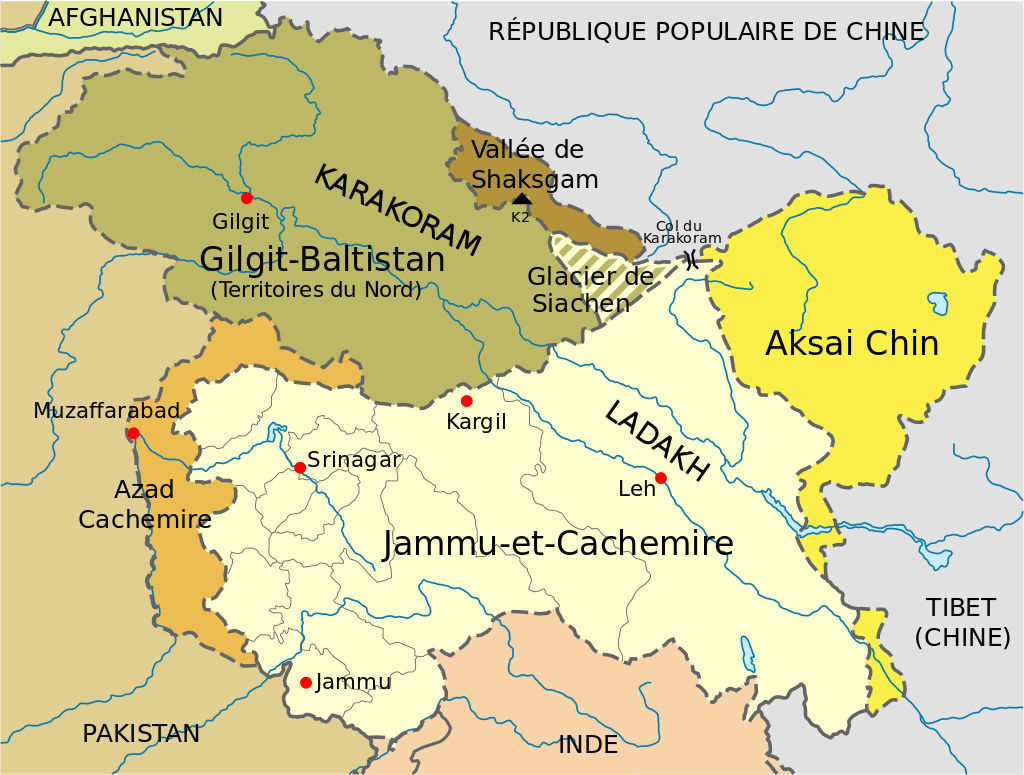 The Karakoram Pass, which gives its name to the entire range, marks the extreme boundary
territories claimed by India, China and Pakistan.
Valleys and glaciers to be "lost".
In those days, there were no maps, no roads, and each valley had its own language and even its own culture. Journeys lasted months, if not years.
From 1835 onwards, Godfrey Thomas Vigne, a famous amateur cricketer (!), was the first to get close to the heart of the massif. He made four successive trips. Starting out in Ladakh, one of his aims was to identify the source of the river Shyok (a major tributary of the Indus). To do this, he tried to cross the Saltoro pass - Bilafond La (5,550 m) - but had to give up due to bad weather.
Adolf, Hermann and Robert Schlagintweit, three brothers from Munich, eminent scientists, had the honour of being recruited in 1856 by the Survey of India to study the geology of the Karakoram. For the first time, Westerners got close to the ice of the Baltoro. Adolf, driven by his passion for discovery, crossed the "old" Mustagh Pass (5,422 m), the shortest passage north of Askole, towards the Yarkand oasis in China. Captured and accused of espionage by the Emir of Kashgar, he was beheaded!
That same year, Thomas George Montgomerie identified K2 as the second highest peak on the planet.
Another soldier, Lieutenant-Colonel Henry Haversham Godwin Austen, trained with Montgomerie. Despite his young age (23), his skills as a topographer, geologist, explorer and draughtsman earned him a commission from the Survey of India. From 1857 to 1861, Godwin Austen worked his way through the immense moraines of the Baltoro glacier. Arriving at Urdokas, 27 kilometres from K2, he determined its precise altitude by rising 600 meters above the camp.
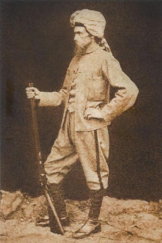
Henry Haversham Godwin Austen, talented soldier, geographer, draughtsman and watercolourist.
Barely 24 years old, Lieutenant-Colonel Sir Francis Younghusband set off on a long journey from Peking to Rawalpindi across the Gobi Desert. Leaving Peking on 4 April 1887, he crossed the Aghil pass (4,805 m) and reached the banks of the Shaksgam river at the end of September. The North Face of K2 opened up before his astonished eyes. This was followed by a perilous crossing of the "new" Mustagh Pass (5,750 m), which established his reputation. Without ice axes or crampons, without suitable footwear and without a tent, he and five companions crossed this glacial pass, unknown at the time, to reach the Baltoro at Urdokas. The icing on the cake: bivouacs under the stars.
.png)
Descending Mustagh Pass, amidst the crevasses. The guide Balti, armed with a common pickaxe (!) cuts the steps. Four porters and Younghusband follow him, using pointed sticks. Forbidden to fall © Francis Younghusband
.
At the foot of the Mustagh Pass, ski expedition in 2004 © David Hamilton - High Adventure
The Survey of India sent him back into the field in 1889. He entered the Shimshal valley, renowned for its bandits. He then followed the course of the Shaksgam river, climbed the Urdok glacier and reached the Indira pass (5,775 m), also known as the "Younghusband saddle", which gives access to the upper Siachen glacier. Today, this pass marks the junction of the hotly contested borders between India and Pakistan.
Mountaineers take centre stage
Sir William Martin Conway, a contemporary of Edward Whymper and a brilliant young mountaineer, opened a new route on the Zinalrothorn (4,222 m) in the Valais Alps at the age of 22. In 1892, he was 36 years old. Here he was in the Karakoram with his guide Matthias Zurbriggen and Brigadier Bruce (future leader of the 1922 Everest expedition). Ascending the Hispar glacier. On 17 July, they crossed the last slopes and expected to find a wide glacial valley on the opposite side. Instead, they discovered an immense snowfield, immediately dubbed "Snow Lake". All around them, sumptuous peaks: the Ogre (7,285 m) and Latok (7,145 m) massifs. Descent along the Biafo glacier to Askole, where they arrived on 26 July. On 1st August, the caravan set off again in the direction of Baltoro. On the 9th, they reached the confluence of the glaciers at the foot of the Gasherbrum.
Conway: "The great Baltoro glacier is formed by the meeting, at the foot of the west face of the Gasherbrum, of three main tributaries. I have named them Godwin-Austen, Trône and Vigne respectively. The Godwin-Austen descends from K2. The Vigne arrives from the south, fed by the snows of the Chogolisa. The Throne divides, about thirteen kilometres above the "Place de la Concorde" (it reminds me of a similar place on the Aletsch glacier in Switzerland), into two branches, and between them rises a massive mountain with rounded shapes. I gave it the name Golden Throne, because it's shaped like a throne and you can see traces of gold in its volcanic rocks."
.jpeg)
Sir William Martin Conway, gentleman himalayiste
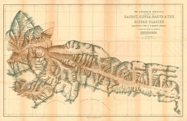
Hand-drawn maps: real works of art
They made the first two ascents of the region. The first was Crystal Peak (5,913m) on 10 August, on the right bank of the glacier. Then on 25 August, they left a camp at 6,100 metres to climb a ridge leading to the south-west antecima of the Golden Throne (Baltoro Kangri): Pioneer Peak (6,970 m). It was a tricky route, with many steps to be cut. At the summit, they spent long minutes taking readings using the essential measuring instruments: surveyor's planchette, barometer, thermometer, clinometer and prismatic compass. The only thing missing was the imposing theodolite, which they had had to leave behind during their ascent because it was so heavy and bulky! Finally, at 4pm, they decided to descend. The long walk back to Askole, through the unstable moraines and biting cold (often below -20° at night), was no picnic.
One of the world's greatest glaciers: the Siachen
Doctor Tom Longstaff, who conquered Trisul (7,120 m) in 1907 in the Garhwal Himalayas, was following in the footsteps of Godfrey Thomas Vigne. He wanted to cross the Saltoro pass, where Vigne had been forced to turn back, and explore the north face. In 1909, he succeeded and, to his great surprise, discovered a river of ice 5 kilometres wide. He had set foot on the imposing Siachen glacier (the glacier of wild roses), which Younghusband had glimpsed from the Indira pass in 1889. He estimated its length at over 70 kilometres, making it one of the longest in the world apart from the Greenland and Antarctic ice caps. During the same trip, Longstaff identified the sources of the Nubra and recognised the Saser Kangri massif (7,662 m), the last major summit to the east of the immense range.
The same year, the Duke of Abruzzo organised a reconnaissance of K2. Vittorio Sella produced a series of highly accurate maps and a collection of magnificent photos.
The women's turn
Fanny Bullock Workman and her husband, William Hunter Workman, citizens of the New World, complete the work begun by GT Vigne. Fanny belonged to the indomitable women of the Victorian era: explorer, mountaineer and suffragette. Together, they organised no fewer than eight expeditions to the Karakoram. In 1906, at the age of 47, Mrs Workman set a women's altitude record when she made the first ascent of Pinnacle Peak (6,930 m) in the Nun-Kun massif, near Zanskar. But their greatest feat was the complete ascent of the Siachen glacier in 1912.
.jpeg)
Fanny Bullock Workman, her altitude record will stand for 28 years
Timid foray by the French
In 1936, the Club Alpin Français, which saw itself as the equivalent of the illustrious Alpine Club, launched its first attempt in the Himalayas. When the Nepalese authorities refused, the objective was changed to Gasherbrum I (8,080m). At the age of 35, Henri de Ségogne, a member of the elitist Groupe de Haute Montagne, was at the controls. Departure from France on 31 March. No fewer than 700 Balti porters were recruited to carry 14 tonnes of equipment to the base camp. Unfortunately, despite a fierce battle, bad weather stopped the rope parties at camp V (6,800 m). The base camp had to be abandoned on 2 July.
To conclude
Eric Shipton and Bill Tilman solved one last mystery: the course of the Shaksgam river, once reached by Younghusband, and in 1937 completed the exploration of the entire northern slope. For greater efficiency, they split into two groups and Shipton crossed the Shimshal Pass (4,735 m), opening the way to the eponymous valley approached by Colonel Younghusband fifty years earlier.
By the eve of the Second World War, the glaciers of the Karakoram had revealed many of their secrets. Now it was time for the great expeditions to conquer the summits.
In praise of slowness... or sustainable tourism?
Until 1939, it took twelve days to cross from Europe to Bombay by boat. Forty-two hours by train to reach Rawalpindi (Islamabad) and a long day by bus on chaotic roads to reach Srinagar. Here begins a gruelling month-long journey, on foot and on horseback, to Askole, the last village and the current departure point for the Baltoro treks. In three weeks, the route crosses the Zoji La pass (3,528 m) between Kashmir and Ladakh, passes through Kargil, descends the course of the Suru river to the Indus and leads to Skardu, capital of the province of Baltistan. It takes another week to reach Askole, where the serious business can finally begin: eight tedious days on the moraines to reach Concordia.
Total journey to Askole: six weeks, and the same for the return journey.
As for food, most of the time it consisted of eating local delicacies: frugality and monotony were the order of the day. The wild fauna, fortunately abundant at the time, provided a providential supply of game.
The explorers and mountaineers of those heroic times would choke on the luxury of our travels.
Climb K2 at 8,611 meters in Pakistan.
Text by Didier Mille.
Climb K2 at 8611 meters in Pakistan

 Expeditions Unlimited blog