8000er more technical than the Gasherbrum II, to be combined
Highlights
- Ratio of 2 guides to 1 participant
- Ascent with or without oxygen supply
- Experienced expedition leader
- All single accommodation except altitude camps
- Special care given to high-altitude food
- H24 weather forecast services and medical hotline
- Preparation course, live expedition coverage
- Guaranteed departure from the first participant
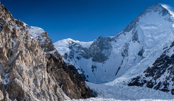
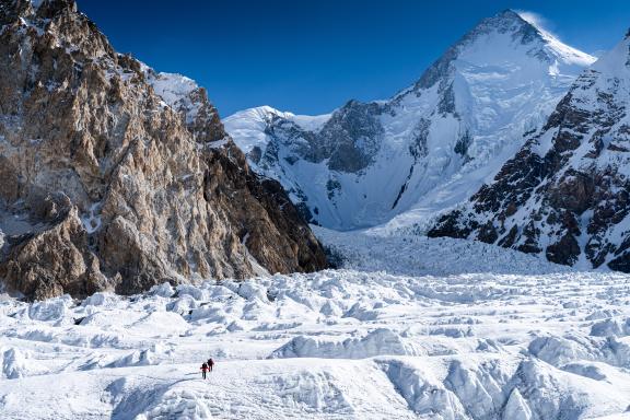
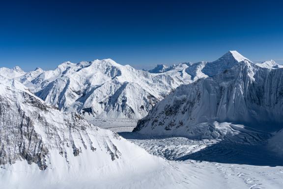
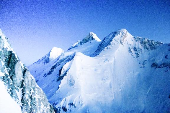
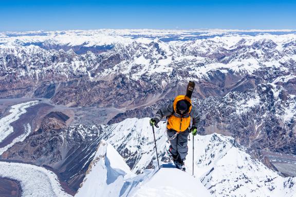
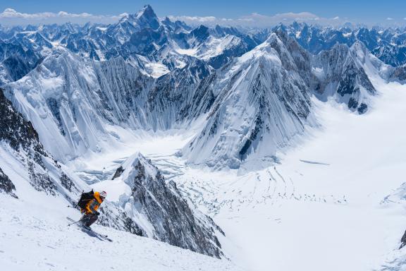
We set off to climb Gasherbrum I (8080 m), the eleventh highest peak on earth. Better known as Hidden Peak, due to its position at the bottom of the Baltoro glacier, hidden behind Gasherbrum IV and II. It is not the long ascent route first climbed in 1958 that is now the regularly used ascent route. The route most often used is up the north-east face, starting from Gasherbrum La, the col separating the two summits GI and GII. It follows what is known as the “Japanese Couloir”, or, if conditions are too avalanche-prone, a spur close to the couloir. Compared to Gasherbrum II, Hidden Peak is considerably steeper and more technical, but offers a very direct ascent to the summit.
Overview
We set off to climb Gasherbrum I (8080 m), the eleventh highest peak on earth. Better known as Hidden Peak, due to its position at the bottom of the Baltoro glacier, hidden behind Gasherbrum IV and II. It is not the long ascent route first climbed in 1958 that is now the regularly used ascent route. The route most often used is up the north-east face, starting from Gasherbrum La, the col separating the two summits GI and GII. It follows what is known as the “Japanese Couloir”, or, if conditions are too avalanche-prone, a spur close to the couloir. Compared to Gasherbrum II, Hidden Peak is considerably steeper and more technical, but offers a very direct ascent to the summit.
The route is common to both summits (GI &GII) up to Camp I. Then it is up the crevassed glacial slopes leading to Gasherbrum La, before embarking on the North-East Face in the proper sense of the word. Three altitude camps are required to reach the summit. Because of its isolation and difficulty, it is the least-visited 8000-meter summit. But the route is largely safe from objective hazards (few seracs).
MOUNTAINEERS' WORDS
These words from the mountaineers who climbed Everest apply perfectly to our ascent of Gasherbrum.
"What is it that makes this summit so fascinating to all mountaineers?... It is the highest mountain in the world... The many expeditions, the men who have conquered it, have not succeeded in making it smaller... The altitude remains." – Reinhold Messner
"We didn't have to wait for the ultimate vision. Above the fog, Everest was still before us...: motionless as Keats's star in its solitary splendor, and so high in the night! Eternal watchman of the shadows, the Mount seemed to inebriate the world with its radiance." - George Leigh Mallory
"Suddenly, it occurred to me that the ridge in front of us, instead of continuing to rise, was falling sharply; much lower down, I could see the North Col and the Rongbuck Glacier; in the foreground, a narrow snow ridge climbed towards a snowy summit; a few more ice axe strokes in the hardened snow... and we were at the summit. It was 11:30 a.m." - Edmund Hillary May 29, 1953
COLLECTIVE ADVENTURE
While it remains an exceptional adventure, the ascent of an 8000er is no longer an undertaking reserved for a very high-level alpine elite. Advances in logistics, mountain equipment, weather forecasting, gear and the physical fitness of mountaineers mean that the world's highest peaks are now accessible to technically autonomous, well-trained and highly motivated mountaineers.
Our expedition will be a collective adventure, a confluence of motivations and energies, a meeting of the capacities of an organization and motivated climbers. Two parallel challenges will have to be met:
- for the participants: to be physically, technically and mentally at the top of their game at all times;
- for the organizer: to provide irreproachable logistics enabling access to the high altitude camps under optimum conditions. Beyond that, it is up to the participants to play their part, taking part independently in the assaults on the summit ridge led by the guide and sherpas.
The main objective of this expedition is to experience an adventure that requires total commitment, both physical and moral, acting with lucidity and humility in a hostile natural environment that forgives no imprudence or temerity leading to death. It is this testimony that must be wisely remembered.
Good observance of all safety rules is essential, as is good physical and psychological preparation, a warm and supportive environment, total serenity, a little tactics and then, if the weather is kind and luck is on your side, you will be able to count down the magic minutes at the summit when effort ceases and nothingness fills the space and instills itself within you.
It is agreed by all parties that giving up is never a failure, but that accepting it can also be a victory over oneself. Any preparation, even the most meticulous, any will, even the most tenacious, can be defeated by the adversity of natural environments whose force is exponentially stronger than the finest human intelligence. Let the gods bless us and allow us to tread the summit.
THE MOTTO IS: DARE TO CLIMB, KNOW HOW TO DESCEND
VERY HIGH ALTITUDE
Advice from Hubert Giot, mountain guide. He has taken part in several expeditions to 8000 meters and climbed Everest without oxygen.
It is not easy to establish rules, because mountaineers are not equal when it comes to altitude, either physiologically or mentally. Everyone seems to have their own plateau where they get stuck. Extremely demanding, this stage is always painful, but not unmanageable. Once you are past this stage, everything's fine... or not so bad. It is generally at this point that you get a better idea of your ability to adapt. This can happen as early as 6000 meters, or even earlier, during the approach trek.
High altitude also has its own rules, and transgressing them becomes inherently dangerous. There is a fundamental difference between climbing to 8000 meters and descending immediately, and staying there for 12 or 24 hours.
At this altitude, the trouble really starts, and every minute spent up there leads to an inexorable process of self-destruction. We experience loss of sleep, lack of appetite, apathy and often hallucinatory phenomena.
In short... above 8000 meters, you are being consumed. For novices, anything is possible, just remember a few basic rules. The first few days at base camp serve as a thermometer, and by the third day you are often starting to feel good. It is then up to you to decide how to divide up the stages: either use the usual camp sites, or those defined by the terrain. As a general rule, when you can sleep at 6500 meters without headaches, you are ready to go higher. However, It is a good idea to make two return trips to 7000/7500 meters, to test your potential. During these essential shuttles, it' is important to stay well hydrated. Now It is time to spend an often uncomfortable night at around 7500 meters, then attempt the summit at 8000 meters. If the summit is beyond that, we try to sleep at 8000.
As for the rest, you need to be prepared to use your brain (or what is left of it) rather than your muscles, because meters, beyond 8500 meters, are more costly. And if I say brain, it is because it has to be sufficiently alert to decide when to descend. If it does not, it is a sure death. Doing an 8000 in good conditions is hard, but with cold, wind, snow or a barometric depression, it turns into a nightmare.
As a general rule, here are a few precautions to take:
- don't get too cold;
- don't get too hot;
- cover your head;
- stay hydrated, even in bad weather;
- try to have one hot snack a day;
- during the trek, do not walk bare-chested;
- at high altitudes, keep an eye on each other; don't doze off together;
- never descend alone;
- set limits for yourself, and look out for signs such as mirages, falling asleep and total loss of appetite;
- never hesitate to turn back, whatever the pressure;
- and in all cases, accept the fact that the mountains will always be there.
In short, to evolve at high altitude, you need meticulous preparation, adequate acclimatization, constant and mutual verification, intellectual vigilance at all times, and immediate renunciation in the event of weakness, doubt or danger.
Itinerary
Day 0
EXPEDITION SUMMARY PROGRAM
- Days 1 & 2: International flights to Islamabad
- Day 3: Islamabad – Skardu
- Day 4: Skardu, rest day
- Day 5: Skardu – Askole
- Day 6: Askole – Jola
- Day 7: Jola – Paiju
- Day 8: Paiju – Khorbutse
- Day 9: Khorbutse – Urdokas
- Day 10: Urdokas – Goro II
- Day 11: Goro II – Concordia
- Day 12: Concordia – Shagaring
- Day 13: Shagaring – Gasherbrum base camp
- Day 14 - 35: Ascent of Gasherbrum I
- Day 36: Concordia – Ali Camp
- Day 37: Ali Camp – Khuspang
- Day 38: Khuspang –
- Day39: Saisho – Ushe – Skardu
- Day 40: Skardu – Islamabad
- Day 41: Islamabad, contingency day
- Days 42 & 43: International flights
DETAILED EXPEDITION PROGRAM
Day 1: International flight
Day 1
Day 2: Arrival in Islamabad
Day 2
Arrival of all participants. We are met at the airport by our local team. Transfer to hotel and rest. Depending on your arrival time, short visit of Islamabad and Rawalpindi.
Day 3: Islamabad– Skardu or rest day in Skardu
Day 3
Weather permitting, domestic flight to Skardu, otherwise we take the road to Chilas, famous for its Buddha carvings (11-13 hours by bus) on the Karakoram Highway (KKH) along the Indus.
Day 4: Chilas – Skardu or rest day in Skardu
Day 4
If we weren't able to reach Skardu the day before, we continue along the KKH. Overnight at the hotel in Skardu. We complete the formalities for the trekking permit so that we can leave for Askole the following day.
Day 5: Skardu – Askole
Day 5
We take a jeep up the Shigar valley to Askole, passing through Dassu and crossing a field of lunar-like sand dunes before heading up the Braldo Gorge. The villages on either side of the valley plunge us into a verdant world, contrasting with the mineral atmosphere. Askole is the last village before entering a world of ice and rock, the starting point of our trek.
Day 6: Askole – Jola
Day 6
Today we begin our hike by walking to Jola from Askole. On leaving the village we leave the last cultivated plots to begin our approach to the front of the Baltoro glacier. A bridge, renovated in 2019, takes us off the route leading to the Biafo glacier, before we reach Korofon (3090 m) for our lunch break, under life-saving groves.
Before reaching the torrent of the Panmah glacier, we take a balcony path that gives us our first view of the Baltoro basin. A final bridge brings us to the shady Jola area, where we set up camp.
Day 7: Jola – Paiju
Day 7
In the morning, we resume our walk along the mountainside, between the riverbed and the terraces. On the way, we discover the first views of Paiju Peak (6610 m), Trango Towers (6286 m) and Cathedral Massif (6024 m), the first big walls in the Baltoro Valley. We set up camp at Paiju, in the last wooded area before heading for the glacier the following day.
Day 8: Paiju – Khorbutse
Day 8
In the morning, we leave Paiju on foot for Khorbutse. We set foot on the Baltoro glacier and cross it to reach its left bank, where we catch a fleeting glimpse of the rounded summit of Broad Peak...
At the Khoburtse camp (3800 m), we face the legendary Trango Towers and the famous “nameless tower”, and even at this altitude, we can already feel the high-mountain atmosphere.
Day 9: Khorbutse – Urdukas
Day 9
We continue our trek towards Urdukas. Cathedral and Lobsang will be our reference mountains for this short day. Short indeed, but necessary for acclimatization. Tonight, the mood is relaxed and the porters offer us their first impromptu concert.
Day 10: Urdukas – Goro II
Day 10
We descend to the Baltoro glacier and then ascend it more or less in the middle. Other mythical peaks appear as we progress: on the left bank stands the north face of Masherbrum (7821 m) and on the right bank the fabulous Muztagh Tower (7273 m), whose ascent represented a step forward in the history of mountaineering. It was one of the first expeditions to combine high altitude and technical difficulty. Even today, the Baltoro glacier attracts the most gifted mountaineers, who dream of climbing it and, why not, opening up a new route on one of its fabulous mountains. At the end of the day at Goro II (4280 m), the Gasherbrum IV (7925 m) monopolizes our attention and we are captivated by its beauty, especially at sunset, whose colors give it the nickname of “shining wall”.
Day 11: Goro II – Concordia
Day 11
We end our journey along the Baltoro before arriving at Concordia, a surprising and mythical spot named after the meeting of two mighty glaciers: the Godwin Austen glacier, which melts into the Baltoro glacier. The 360° panorama offers breathtaking views of a whole series of splendid mountains. First of all, the famous K2 (8611 m) and Broad Peak (8047 m), two of the four 8000-meter peaks in the Baltoro basin. Mitre (6013 m) eventually monopolizes the view, and you have to break away from it to contemplate Baltoro Kangri (7462 m), Chogolisa (7665 m), Crystal Peak (6252 m) and Marble Mountain (6266 m).
DAY 12: Concordia – Shagaring
Day 12
The final stage of the approach hike is a little easier than on previous days, and takes us into an extraordinary amphitheatre. The Gasherbrum II comes into view, and the imposing Broad Peak (8051 m) justifies its name “the massive mountain”. Suddenly, looming almost 4000 meters above us, is the summit of K2. Perhaps the most beautiful stage of the approach walk.
Day 13: Shagaring – Gasherbrum base camp
Day 13
The day is devoted to the climb up to Gasherbrum base camp (5150 m), which will allow us to take time to admire the mighty 8000-meter peaks close at hand.
Days 14 to 35: Ascent of Gasherbrum I
Day 14
The ascent requires three altitude camps.
- Base camp: 5300 m
- Camp 1: 5900 m
- Camp 2: 6400 m
- Camp 3: 7200 m
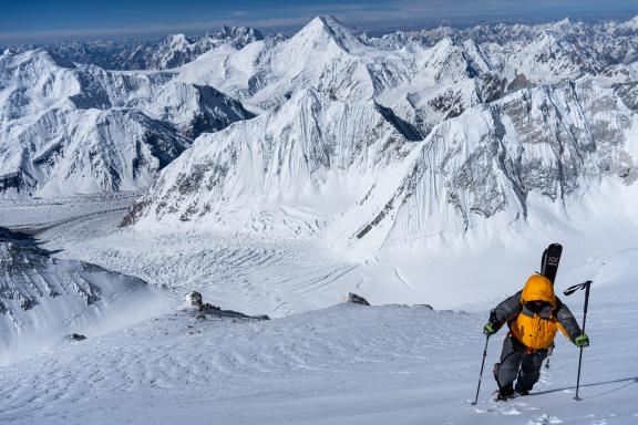
The first step is to reach the foot of Gasherbrum La (6600 m), a characteristic depression on the long ridge linking Hidden Peak to Gasherbrum II. Directly above Camp 2, we climb up the northeast face to reach what is commonly known as the “Japanese Couloir”, a sort of gully between rocky outcrops. Above this, we join snowy slopes that become steadily steeper and steadier until we reach the summit ridge, not far from the summit.
FROM BASE CAMP (5300 M) TO CAMP 1 (5900 M)
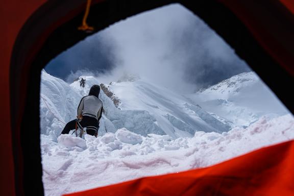
To reach the foot of the south-west ridge, we first have to cross the icefall that defends access. The glacier advances very slowly (nothing like the Everest Icefall), and progress between crevasses and seracs is not particularly difficult, apart from a few short steep passages where fixed ropes are welcome. The various expeditions on site are pooling their efforts to maintain these passages: fixed ropes and markers with numerous flags. Camp 1 stands at the foot of GII's southwest ridge. It takes 6-7 hours to reach it, but this time decreases as your acclimatization improves. By the last pass, you should be able to halve this time.
FROM CAMP 1 (5900 M) TO CAMP 2 (6400 M)
We climb up the vast glacial combe leading to the Gasherbrum La. In recent years, this once easy combe has become more tricky due to the numerous crevasses that have appeared. The route, while not difficult, requires a great deal of attention, particularly on the descent, when you are in a hurry to reach Camp I. The camp is an hour's walk down from the col, at the foot of the northwest face and the Japanese Couloir.
FROM CAMP 2 TO CAMP 3 (7200 M)
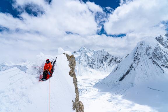
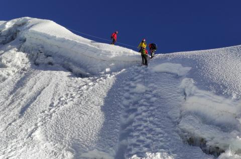
This is probably the most spectacular part of the route. Progress varies greatly from year to year, depending on snow conditions. If the snow is good, it is best to follow the obvious couloir between two rocky spurs, the “Japanese Couloir”. If the snow is too heavy, it may be preferable to choose a passage between the rocks to limit the risk of avalanche. Slopes average 45°. A few passages in mixed terrain. Camp 3 is set up at around 7200/7300 m at the top of the rocky spurs, on a good platform.
FROM CAMP 3 TO SUMMIT (8080 M)
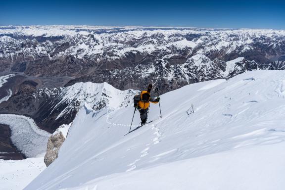
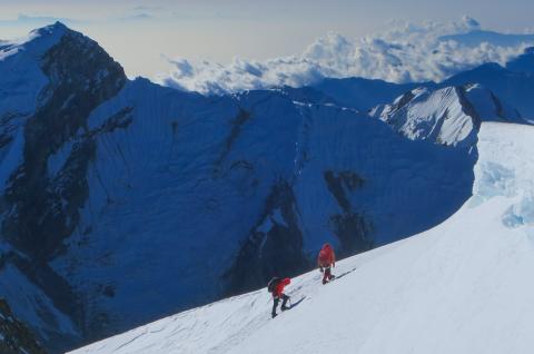
A long ascent on snowy slopes that become steeper and steeper until they reach 55°. Here again, snow conditions and the difficulty of making the trail play an important role in the success of the ascent. It is best to head straight for the summit, as the very tapered summit ridge is not ideal for progression.
Estimated time: a good fifteen hours from Camp 3 to the summit and back.
Day 36: Concordia – Ali Camp
Day 36
We turn our backs on K2 to head for the Vigne glacier. An early start is necessary to avoid the pitfalls of this glacier. Even if the valley floor attracts us, it is important to look back from time to time, to admire K2, Chogori or the “wild mountain”, which remains the most majestic of the place. We leave Ali Camp on the left bank to skirt around the last crevasse, to reach it on its rocky promontory and set up camp, our last on the Baltoro watershed.
Day 37: Ali Camp – Gondogoro – Khuspang
Day 37
We set off at night by headlamp, to take advantage of the best conditions to reach the foot of the Gondogoro Pass, which will take us to the other side. For many years, the Hushe Rescue Team has arranged the ascent and descent of the pass, so we have to use the fixed ropes set up on the steep parts of the pass. The aim is to reach the col (5625 m) at sunrise, to admire the blaze of K2 and the superb view of Laila Peak (6096 m). Snow, ice and rock conditions are, of course, subject to change over the course of the season and according to the vagaries of the weather.
Once we have crossed this part of the route, we begin a beautiful descent to Khuspang, where we set up camp next to a lake with a beautiful view of Laila Peak.
Day 38: Khuspang – Saisho
Day 38
Day 39 : Saisho – Hushe – Skardu
Day 39
Today we set off on our last day of trekking, and after a good three hours' walk we finally reach the village of Hushe. After more than ten days in a high-altitude, mineral environment, we are back in the Balti village atmosphere, which is not to our displeasure. All that remains is to thank the local team before setting off for Skardu and a night at the hotel (5 hours in a 4x4 vehicle).
Day 40: Skardu – Islamabad or Chilas
Day 40
Depending on the weather, we fly from Skardu to Islamabad. Once in the capital, we have the rest of the day to visit the city, including the Shah Faisal Mosque and the Lok Virsa Museum (Heritage Museum), which boasts a magnificent and comprehensive collection of handicrafts from the country and Central Asia. If the flight is cancelled, we take the road to Chilas (8 hours) via the KKH, keeping the Indus as our guiding thread and looking out over the Nanga Parbat (8126 m).
Day 41: Islamabad or Chilas – Islamabad
Day 41
Day 42: International return flight from Islamabad
Day 42
Depending on your flight schedule, you are accompanied to the airport to catch your international flight to Europe.
Day 43: Arrival in Europe
Day 43
END OF EXPEDITION
For reasons that cannot be foreseen at this stage, such as unpredictable weather, the physical fitness or lack of fitness of participants or other circumstancess (customs formalities, road conditions, traffic, landslides, force majeure, etc.), your expedition leader may have to adapt the program, if necessary, to ensure the smooth running of your trip. He remains the sole judge and the one who guarantees your safety. Activity times are given as an indication and may vary from one participant to another.
The itinerary for all our expedition programs, or the ascent program for our high-mountain expeditions, are given here as a guide only. They are flexible enough to adapt to weather conditions with a few contingency days. In any case, you should follow the recommendations of your guide, who may suggest that you cancel your expedition due to weather, safety or physical conditions.
It is important to remember that this is a truly unsupported expedition, and that anything can happen. Expeditions Unlimited, your expedition leader, your guide or our local teams can in no way be held responsible.
Any costs incurred as a result of a change in the expedition schedule (extra nights' accommodation, extra flights) will be borne by the participants and not by the organizers. "Contingency days" refer to the expedition in the strict sense of the term (base camp/base camp in the mountains, departure point/exit point on a traverse, etc.).
Any early return of the expedition or of certain members only (early success, abandonment, etc.), generating costs for accommodation, meals, changes to air tickets or other activities not provided for in this program, will be charged in full to the participants.
Trip notes
Guiding
PAKISTANI AND NEPALESE TEAM
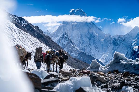
Logistical support for the first expeditions to Pakistan was provided exclusively by the Pakistanis themselves. For a long time, local regulations prohibited the use of other nationalities, whether for portaging to base camps or for setting up high-altitude camps. Over the years, this situation has changed, as have administrative constraints. That's why we also work with Nepalese teams who bring their exceptional physical qualities to high altitude. Particularly Balti porters are a marvel on the long route to the Baltoro base camps. And most of the time, we also call on the best Pakistani high-altitude guides, who have often climbed “their” 8000 without oxygen.
YOUR PRIVATE GUIDES
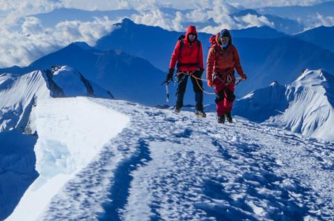
Key to your success on all our expeditions, we maintain a ratio of two altitude guides per participant. They accompany you during the key moments of the ascent and during the summit push. They are particularly experienced at high altitude. They have participated in several expeditions over 8000 meters, successfully leading participants to the summit. We select them for you. They generally speak English. The two of them may not be permanently at your side during rotations between camps, their roles also being to carry the loads to set up the camps.
For this climb, here's the exceptional ratio that's expected:
- 2 guides for 1 participant
- 4 guides for 2 participants
- 5 guides for 3 participants
- 6 guides for 4 participants
There is a summit bonus for your guides, to be paid in cash on site after the climb. This bonus is due from the moment you leave the last summit camp on your summit push attempt. If one of the two guides has not climbed to the summit with you, then he receives a tip for the work he has done on your expedition.
EXPEDITION LEADER
The expedition leader plays an important role in implementing the strategy required for success: rotation in the high altitude camps, acclimatization of each participant, study of weather reports to decide on the optimum moment to launch the summit push.
The expedition leader represents Expeditions Unlimited to the group, our partners and the local authorities. He relies on the information we give him throughout the expedition. He may be based at base camp, but more often than not, he accompanies you to the high altitude camps to oversee the smooth logistics of the expedition. He takes the necessary decisions that may be required. His authority is paramount and inescapable. You must respect his decisions, as well as those taken collectively.
From one to five participants, you have a local English-speaking expedition leader who has coordinated numerous expeditions to peaks over 8000 meters. This can be shared with other expeditions.
From six participants upwards, you have an experienced French expedition leader dedicated exclusively to your expedition.
LOCAL TEAM
For a project involving the ascent of a major Himalayan peak, our team is particularly well-equipped to deal as effectively as possible with the two key issues of an expedition: technical supervision and the carrying of equipment (food, collective and personal equipment). This is an important issue, as it directly affects the success of both parties. The result of more than 10 years of joint reflection and work, our operation is optimized and the tasks entrusted to each person determine their very specific status.
A kitchen team will be present at base camp.
There is a team of porters who help us set up base camp with all the equipment and cooking facilities. Beyond that, the team of high-altitude sherpas takes over. In particular, they help us set up the high-altitude camps and portage from base camp.
Each participant is responsible for carrying his or her own personal belongings and high-altitude food. Collective equipment is carried by the sherpa team. Our rucksack will weigh between 10 and 12 kg.
And throughout the program, we shall rely on other local skills as needed. Finally, we will have access to an experienced weather router and a high-altitude doctor from Ifremmont (see above).
For unpredictable reasons at this stage, like adverse weather conditions, insufficient physical condition of participants, insufficient competencies of participants related to the intended activities, your guide may decide to adjust the intended program and/or activities. At all times, his decision will be final on all matters likely to affect the safety and well-being of the trip.
Difficulty level
Level rated: extreme
This program is intended for experienced participants, who have a high level athlete's physical and mental condition.
It is classified as an "Extremely Difficult" climb, given the very high altitude at which you will be working. Gasherbrum I is one of the highest mountains in the world: although the technical difficulties are relative, climbing to the summit is nonetheless a difficult and sometimes even dangerous undertaking. Attempts to reach the summit involve a high degree of commitment.
This expedition is therefore designed for experienced mountaineers with a good knowledge of very high altitudes (with AD level snow skills _ AD = Fairly difficult). It is essential to be totally self-sufficient in the mountains, both technically and psychologically. The expedition leader and guides are primarily technical advisors and logistics managers. Under no circumstances can they "pull" a participant towards the summit.
Rigorous training is of course essential, focusing on developing endurance and stamina: running, cycling, swimming, cross-country skiing and, of course, mountain climbing. This training must be regular and begin at least 6 to 8 months before the start of the expedition.
Preparation will continue to be carried out in constant liaison with the organizer and guide. Particular attention will be paid to safety and the management of high altitude hazards.
High altitude is, of course, the major problem we face. The process of oxygen deficiency (hypoxia) is at its peak when climbing a peak such as a 8000er. Progressive acclimatization is essential to offset this phenomenon as much as possible. During the first few weeks, you need to take it easy, avoid violent efforts and go at your own pace. Although "secondary" symptoms such as migraines and nausea are virtually unavoidable in the early stages, be careful not to ignore them, as they can trigger an oedematous process.
For a relatively long period of time, the body will be subjected to considerable physical effort in a difficult environment, with the added handicap of high altitude. Serious physical preparation is essential for an expedition of this scale: you will need to work on your stamina and endurance, even in difficult climatic conditions (cold, wind).
It should be noted that we offer climbers who wish to attempt an ascent without taking oxygen to successfully reach the summit. Most will take supplemental oxygen from the last camp around 7000 meters. The organization and in particular the ratio “1 altitude sherpa for 1 participant” during the summit push ensures slightly differentiated and personalized ascent rhythms. Do not hesitate to discuss this with us.
Beware of carrying: while collective equipment is carried by the sherpas, personal belongings must be carried during the ascent; not doing so at all would be highly detrimental to summit attempts, during which a bag of some weight (6 to 8 kg) must be carried, since it will have to contain oxygen cylinders (4 kg).
On an expedition, participants are confronted with a hostile environment due to its remoteness, cold, bad weather and discomfort, all of which can generate stress. Fatigue can be the cause of mood and relationship disorders. Everyone must therefore show good mood, tolerance and respect, not only towards the members of the expedition, but also towards the local team. The group may split into sub-groups according to individual affinities. Keep in mind that it is the core team that prevails and that, as always in this type of project, the key to success remains the collective and team spirit.
Therefore, participation in the preparation course, the date of which will be specified later, is mandatory. In addition, mountaineering preparation courses as part of our Adventure School can be a serious asset, both to build confidence and to gain autonomy.
To register for this expedition, you will be asked to provide an expedition (mountain climb list)/trek/athlete CV. A hypoxic stress medical test is also mandatory, as is a medical certificate for completing an ascent in the Himalayas.
You benefit, free of charge and for the duration of your expedition, from membership in the 24/7 high altitude medical service set up with our partner Ifremmont, of which we are partners. See below.
If you have any health problems that you feel could compromise the success of your expedition, please let us know so that we can assess together whether they are compatible with this expedition. And we strongly advise you to have a check-up with your dentist before departure, given the length of the expedition and the significant variations in altitude and pressure.
Last but not least, we can provide you with a sports coach and/or a mental coach for the months leading up to your expedition, to help you prepare in the best possible conditions. We have developed remote protocols in this field, just as we have built a hypoxia preparation protocol which we describe later in this document in the chapter devoted to Ifremmont.
In the longer term, we offer refresher and advanced mountaineering courses as part of our Adventure School, as well as expeditions to peaks at 5000, 6000 and 7000 meters, offering you the ideal progression towards your dream goal at very high altitude.
Technical difficulty
Mountaineering level: fairly difficult(ad)
In this program, the use of mountaineering equipment (crampons, harness, ice axe, ropes, etc.) is necessary, and the route tackled may involve minor difficulties, whether it be slightly steeper passages in a glacier run, the height of the wall, the commitment of the run or the continuity of effort. Of course, altitude makes everything more difficult. Steep or more arduous passages are all equipped with fixed ropes, so you need to be comfortable with a self-locking handle in all situations. This climb is aimed at participants with previous mountaineering experience and who have already completed climbs of this level.
This technical rating applies, of course, to normal weather conditions: difficulty can increase in poor conditions, with fresh snow for a rocky route, insufficient or poor-quality ice for glacier mountaineering, etc., and the situation can change radically if the weather is not too bad. Similarly, the situation changes radically, for the same technical level, with altitude, the weight of the rucksack, the lack of equipment for the route on site, the fatigue linked to the approach if it is long, the particularly hostile environment, and so on.
Our École de l'Aventure's three-to five-day mountaineering courses are designed for you, and are the perfect way to make sure you are at the right level.
Meeting point
We meet up in Islamabad and are welcomed at the airport by our local teams.
Given the diverse origins of the participants on this trip, international outward and return flights are not included in this package. In most cases, we book flights on your behalf to ensure that the whole group arrives at the destination at the same time. We do not charge any fees for these air bookings. Please do not hesitate to contact us. If you book your own tickets, we will advise you on the ideal flight schedule to enable all participants to arrive within a reduced time frame. At the very least, you need tickets that can be modified.
Accommodations
ISLAMABAD, SKARDU AND OTHER VILLAGES ON THE KKH
In a single room in a 3/4-star (***) hotel accommodation according to local standards.
BALTORO GLACIER TREKKING
In guesthouses for the first stages, in 3-person tents for 2 during the trek.
BASE CAMP
At base camp, we stay in individual tents.
As a base for several weeks, it needs to be as comfortable as possible, to enable us to recover properly on our return from the altitude camps. It should also enable us to cope with periods of bad weather in the best possible conditions. Each participant has his or her own individual tent with a comfortable mattress. A mess tent, heated during dinner (from 6 p.m. to 8 p.m only) and for early morning departures towards higher camps, is the main living area. Tables and chairs are permanently installed. We also have a shower tent and a toilet tent (solid waste is disposed of in drums).
HIGH ALTITUDE CAMPS
During the ascent, at the altitude camps, we have an altitude tent for 2 people, and even 3 people at the last camps.
Hygiene & laundry
Toilets: The base camp is equipped with toilets and toilet paper. Make sure you wash your hands with a hydro-alcoholic gel (available from your personal pharmacy) after each use of the toilet. For the higher camps, we recommend that you take a bottle with you to urinate in at night, to avoid having to go outside.
Daily hygiene: a basin with soap and water is available at the entrance of the mess tent. Water for washing hands and face; do not drink.
Showers: hot water available (request from kitchen). Showers should only be taken on sunny days to avoid catching cold!
Laundry: (cold) water and basin to be requested from the kitchen. Bring biodegradable products only.
Meals
ISLAMABAD, SKARDU AND OTHER VILLAGES ON THE KKH
On arrival in Islamabad, a welcome dinner is offered on the first evening. Similarly, on your return from the expedition, a farewell meal is provided.
In the towns, there are many small (and large) restaurants where you can sample typical local cuisine. With the exception of Islamabad, breakfasts and evening meals are prepared by the kitchen staff or our cook and served in the mess tent. Depending on the profile of the stages (length of the day's walk and/or presence of water), midday snacks will be served hot or cold in the form of picnics.
BASE CAMP
HIGH ALTITUDE CAMPS
At altitude, you often have to force yourself to eat. The use of freeze-dried food is almost unavoidable. But such dishes, appetizing in the valley, quickly become a source of disgust in high altitude camps. During the preparation course, we bring a sample of lyophilized dishes for you to taste, to indicate your preferences, which we do our utmost to respect (depending on the stocks available at the time of final purchase). You can also bring along a few of your favorite dishes (if you have any)or small snacks that give you pleasure, or energy bars as the ones on offer locally are sufficient but basic, and so on. Be careful with the weight – we are talking about a kilo in all! For your comfort and the pleasure of tasting, we have included a few "delicacies" from France (savoury and sweet).
Each tent has a stove for melting snow (MSR Reactor type) and making water for freeze-dried food and hot drinks. The necessary gas cartridges are supplied.
HYDRATION
Take along tablets (such as Hydroclonazone, Micropur or others) to disinfect the water you put in your water bottle, depending on the source and on the advice of your guide. It is sometimes possible to buy purified water and fill your bottle without having to buy bottled water, which is not environmentally friendly.
Besides, glacier meltwater contains no mineral salts, which is partly compensated for by the soups and other meals you' will be eating. But if you only drink tea or coffee made from glacier meltwater, or just water in your water bottles, over a long expedition, you will hydrate less well, risk gastric problems and, ultimately, deficiencies that will tire the body. To counter this problem, it is a good idea to pack mineral tablets in your luggage at some point, to supplement your water bottle. Two or three tubes of ten tablets are all you need.
Transfers / Transport
Transfers to and from the airport are by minibus. The itinerary is planned by 4x4 or minibus. In the event of cancelled domestic flights, we take the road, which can be poorly maintained in places.
Group size
The group is composed of 1 to 10 participants maximum. The number of participants is deliberately limited to allow for greater immersion, to avoid embarrassing our hosts, and to develop freedom and flexibility. However, the maximum number may be exceeded if the last person to register wishes to travel with one or more other people. The services will not be modified, and the conditions of the trip will remain the same.
Equipment
COLLECTIVE EQUIPMENT
All logistical equipment is provided, including individual tents at base camp with mattresses, mess tent, shower tent and toilet tent, as well as all collective and individual cooking equipment. At altitude, tents, stoves with gas cartridges, ropes and anchors.
INDIVIDUAL EQUIPEMENT
Personal equipment is not provided. A full list is given later in this document. It will be refined with us during the preparation course and up to the moment of departure, depending on your questions.
High altitude sleeping bags, full-body down suits and/or good-quality down jackets are expensive items that you may not use frequently. We can rent you this specific equipment for the duration of the expedition. You must then return the equipment cleaned and in the condition in which it was given to you (deposit required). The rental price will be communicated to you on request. The cost of transport remains your responsibility, unless you pick it up at the agency in Lyon.
OXYGEN OR NO OXYGEN
For safety's sake, high altitude sherpas always use oxygen, even at reduced flow rates.
The vast majority of participants in all Gasherbrum 1 expeditions take oxygen from the last camp around 7200 meters. We therefore include in your package the oxygen supply from this last camp, that is two cylinders, one regulator and oxygen mask and one cylinder with mask and regulator for the altitude guide. Cylinders and equipment are transported to altitude camps by altitude sherpas.
If you wish to use additional oxygen before the last camp, you will need to ask your expedition leader and/or sherpa as soon as possible during your expedition, and additional cylinders will be charged extra. Oxygen cylinders not included in the package must be paid for on site.
That said, we are one of the few organizers to allow our participants to attempt the summit without supplemental oxygen. Our experience shows, however, that it is perfectly possible. The organization, and in particular the ratio of "1 high altitude sherpa to 1 participant", means that the pace of ascent can be slightly different and more personalized. So we can have participants in the same group who need oxygen and others who don't.
If you choose to attempt the climb without the use of oxygen beyond the last camp, then you need to talk to us as soon as possible to fine-tune your acclimatization. Your choice will depend on the agreement of your expedition leader and/or your sherpa, who will assess your fitness during the first rotations. Please note that if you choose not to use supplemental oxygen for your ascent, no refund will be given. For safety reasons, one oxygen cylinder per participant is provided at Camp 3, whatever your choice and whether you use it or not.
SECURITY AND COMMUNICATION
We have a minimum of one Iridium satellite phone for the group, which is used for logistical, weather and safety purposes only. Under certain conditions, participants may make use of it. For private use, please contact us.
The camps will be permanently linked by radio. Expedition leader, participants and high-altitude sherpas will also be able to use them.
The expedition will have a hyperbaric chamber at base camp, and a full pharmacy, though lighter, at the upper camps.
The group will be equipped with a Garmin Inreach beacon, enabling you to communicate freely and without restriction with your friends and family, wherever you may be on the mountain, as well as sending tracking and safety information. It is on this beacon that you will receive weather forecasts and that we will communicate together regularly.
At the same time, we will provide live coverage of the expedition for the general public, including a logbook and photographs, enabling you to share your adventure with your community. To this end, and if the base camp is not equipped with wifi or 4G, you can also use an IridiumGo system to send your photos. These systems are simple to use, but require a few tests before departure, which we will carry out together.
In addition, at the time of writing, all participants are free to bring any systems they have. We just need to be able to declare them to our contacts, so please let us know in advance.
Please note: in order to preserve the serenity of this expedition and the privacy of the participants, we ask you not to communicate with the general public during the expedition. You are, however, free to send information about yourself to your private sphere. By registering for this program, you accept this essential clause to protect the privacy of other participants in a project of this scale, where important issues of image, physical risk and financial considerations (sponsors, etc.) are at stake.
Our commitments to sustainable development
Our commitment to a better planet has been a reality since the beginning of our story but we always need to do more and better. Please find out more about our charter and our commitments in terms of sustainable development. We have drafted our charter and take action through six themes on which we act as concretely as possible, most often with you: social equity and cultural respect, preservation of water, waste management in expedition, protection of biodiversity, raise public awareness on these subjects and finally, the optimization and recovery of CO2 emissions.
Regarding carbon emissions, most of which are due to air travel, we calculated and communicated in 2018 on the carbon footprint of each of our programs, expressed in tonnes of CO2.
These calculations made us aware of the importance of the total carbon emissions generated by our activity. Also, we have committed in 2022 to a carbon reduction that we believe is unprecedented in the tourism industry, aiming to reduce the total emissions of our activity by 5% per year, taking 2019 as the reference year (3,430 tonnes of CO2). This commitment is in line with the trajectory of the Paris climate agreements of 2015, the current benchmark. Thus, in 2030, we commit ourselves not to exceed 2,160 tonnes of C02. Thus, our maximum “carbon” budget for 2024 is 2,950 tonnes and for 2025, this budget will be reduced to 2,800 tonnes. And so on until 2030. To find out more about all of our calculations and our commitments in terms of reducing our carbon emissions.
In addition, since 2019, we have been encouraging you when you book for your journey to contribute with a donation to an independent NGO, among the two we have selected that share the commitments made in our charter. We matched the amount of this donation to this program's carbon footprint. Thus, the journey you are considering generates 3,06 tons of CO2, which corresponds to a 100% donation of €92 for an estimated value today of €30 per tonne of CO2. This donation remains of course optional and you can decide to give between nothing and 100% of this amount. Since 2019, including covid years of 2020 and 2021, we have been able to collect thanks to you nearly €7,000 for these associations.
Please do not hesitate to come back to us with any questions you might have regarding this carbon footprint mechanism, our other sustainable développement commitments or even to share with us your experience through a chat or a mail at contact@secret-planet.com.
Expedition leader
We rely on the most experienced high altitude expedition leaders. They are part of our close community and co-opt each other. They know each other well and respect each other.
For this expedition, the expedition leader has not yet been formally appointed, but should be shortly.
In addition to their exceptional expeditions experience, our expedition leaders have the know-how to optimize the expedition's chances of success, both in terms of group management and in terms of the pace at which the group builds up its strength and progresses in altitude, key elements in this type of expedition.
Departures and pricing
Please find below all dates and prices for this expedition. Prices are quoted "from" and may be adjusted notably according to the number of participants (see trip notes for details). Please note that dates and prices for years beyond 2024, when given, are for guidance only and are subject to change and readjustment to take account of current economic realities.
No date works for me!
I initiate a new datePrice includes
- Welcome dinner on arrival in Islamabad
- 3/4-star (***) hotel accommodation in Islamabad and Skardu with breakfast, single room for five nights
- Airport/hotel transfers in Islamabad
- Return transfert (flight or 4x4 depending on weather) Islamabad/Skardu
- Full-board accommodation during the trek Skardu/base camp/Skardu
- Base camp food supply
- Carrying of personal belongings during the trek Skardu/base camp/Skardu
- Equipment required for life at base camp: fully-equipped kitchen tent, mess tent for meals with heating and solar lighting, toilet tent, shower tent, table and chairs.
- A cook and his assistant at base camp
- At base camp, one tent per person, with mattress, pillow and solar lamp
- High-altitude tents, high-altitude food, stoves and fuel
- Insurance for Pakistani porters, altitude guides (evacuation, hospitalization, medical expenses, life insurance), for the cook and his helpers
- Experienced French mountain guide from 6 participants. For less than 6 participants, the expedition leader is local, and his mission can be carried out by one of the most experienced altitude guides (see below)
- Local mountain guide (sirdar) with extensive experience in managing local teams
- Logistics manager and local manager at base camp, highly experienced guide and instructor
- 2 local altitude guides for every 1 participant, he carries food and equipment to the high- altitude camps and supports you on the final ascent
- 2 oxygen cylinders with mask and regulator per participant
- 1 oxygen cylinder with mask and regulator per altitude local guide
- Collective equipment required for ascent (fixed ropes, moorings, etc.)
- Equipment allowance, fees, tent and food for cook and helpers
- 1 satellite telephone at advanced base camp (for rescue purposes only)
- 1 walkie-talkie for each rope party (participant and 1 altitude guide )
- Solar panels at base camp for charging small electronic equipment (such as cell phones and cameras). Not sufficient to charge computers
- Taxes and climbing permit, rope fixing fee, all government environmental taxes and garbage deposit
- Personalized weather forecast services
- Medical follow-up by Ifremmont during the expedition (see above)
- Preparation courses (practical, medical)
- Live coverage of the expedition for your community (supply of InReach beacon, IridiumGo and subscriptions, LivExplorer service configuration)
Price does not include
- International flights
- Consular fees (visa)
- Any customs taxes upon arrival in Pakistan
- Import taxes, if any, for satellite phones, professional communications equipment and commercial film shooting
- Any additional hotel nights in Islamabad (over 5 nights)
- Any helicopter transfers
- Meals in Islamabad and Skardu other than breakfasts, welcome meal and farewell meal
- Expenses related to the early return of the expedition or of certain members only (early success, abandonment, etc.), generating costs for accommodation, meals, changes to air tickets or other activities not provided for in this program
- Expenses related to a shift in the expedition schedule (extra nights' accommodation and meals, additional airfares)
- US$1,500 summit bonus for your altitude guide, to be paid on site after the ascent (whether the summit is reached or not)
- Tips for the local team, 500 US$/participant
- Any personal communications by satellite phone (to be paid locally)
- Personal equipment, including individual high-altitude gear
- Rental of personal high-altitude equipment, subject to availability
- Any additional oxygen cylinders (approx. US$600, to be paid locally, subject to availability)
- Pre-acclimatization protocol developed with Ifremmont and physical and/or mental preparation with a specialist Sport Altitude coach as described above
- Drinks and personal expenses (sightseeing, cabs, souvenirs, dry-cleaning, etc.)
- Travel and expedition insurance (assistance, evacuation and repatriation)
Your custom expedition
We put our expertise, our knowledge of the terrain, our creativity, our experience, the quality of our guides and the reliability of our partners at your service to build your custom expedition. We can also personalize an expedition to your wishes as soon as you form a "closed" group, whatever the number of participants.
This means that, unless you authorize us to do otherwise, no outside participants join you, and we can personalize your expedition by adapting it to your own pace, with the program extensions you desire, a higher level of comfort, certain activities, other encounters, etc.
Every expedition of this type is subject to a specific quotation. To get in touch with us now, please fill in the short questionnaire below. One of our experts will get back to you to refine your request and make you a proposal.
